 WEST PALM BEACH, Fla. (AP) -- Tropical Storm Katia was gaining strength Wednesday in the Atlantic Ocean and is likely to become a hurricane, but forecasters said it was too soon to determine where it might head.
The National Hurricane Center in Miami cautioned the public - still recovering along parts of the East Coast from Irene - not to stress over the storm yet, even though it's over warm waters and in a low wind shear environment, two ingredients that could propel it to become a major hurricane.
"It's got a lot of ocean to go. There's no way at this point to say if it will make any impacts, let alone when it might make them," said Dennis Feltgen, a meteorologist and spokesman at the National Hurricane Center. "There's a reason we don't do forecasts more than five days in advance - the information just isn't good. The error beyond that just isn't acceptable."
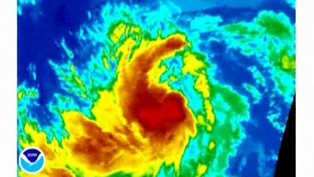
As of 11 a.m., Katia was centered about 1,100 miles (1,765 kilometers) west of the southernmost Cape Verde Islands and was moving west-northwest near 21 mph (33 kph).
Maximum sustained winds were near 65 mph (100 kph) Wednesday, just shy of the hurricane threshold of 74 mph. It was expected to continue strengthening over the next day or two.
Some models showed Katia veering away from the East Coast. But Feltgen said it's simply too soon for coastal residents to tell.
"Folks along the East Coast shouldn't be getting a lot of heartburn over this - not yet," he said.
The storm's name replaces Katrina in the rotating storm roster because of the catastrophic damage from the 2005 storm that devastated New Orleans and the coast. The World Meteorological Organization maintains six rotating lists of storm names, but it strikes names associated with storms that were catastrophically deadly or costly.
Meantime, in the Pacific Ocean, forecasters were monitoring a tropical depression that developed Wednesday. It was located about 75 miles (120 kilometers) west-northwest of Zihuatanejo, on the southwestern coast of Mexico. Maximum sustained winds were about 35 mph (55 kph), and it was moving at about 7 mph (11 kph).
© 2011 The Associated Press. All rights reserved. This material may not be published, broadcast, rewritten or redistributed. Learn more about our Privacy Policy and Terms of Use.


 at the 31st MLK Breakfast, Portland, Jan. 16, 2017 (Mike Norris)")


")


 with Gov. Kate Brown (right) at The Skanner's 31st MLK Breakfast, Portland, Jan. 16, 2017 (Antonio Harris)")


")


")


")


 at the 31st MLK Breakfast, Portland, Jan. 16, 2017 (Mike Norris)")


")


 with Gov. Kate Brown (right) at The Skanner's 31st MLK Breakfast, Portland, Jan. 16, 2017 (Antonio Harris)")


")


")


")


